

You must log in or register to comment.
Looks like a planning map for high speed rail to me
The east / west division in the cost of light bulbs.
I named it Gerald.
The community is called No Stupid Questions but apparently it does have stupid answers.
Okay in all seriousness, this kind of comment is not helping the asker at all.
Maybe not, but it apparently helped mildly amuse significantly more folks than it pissed off so I’m happy with it.
To me it looks more like a Bertha.
Geoplot?
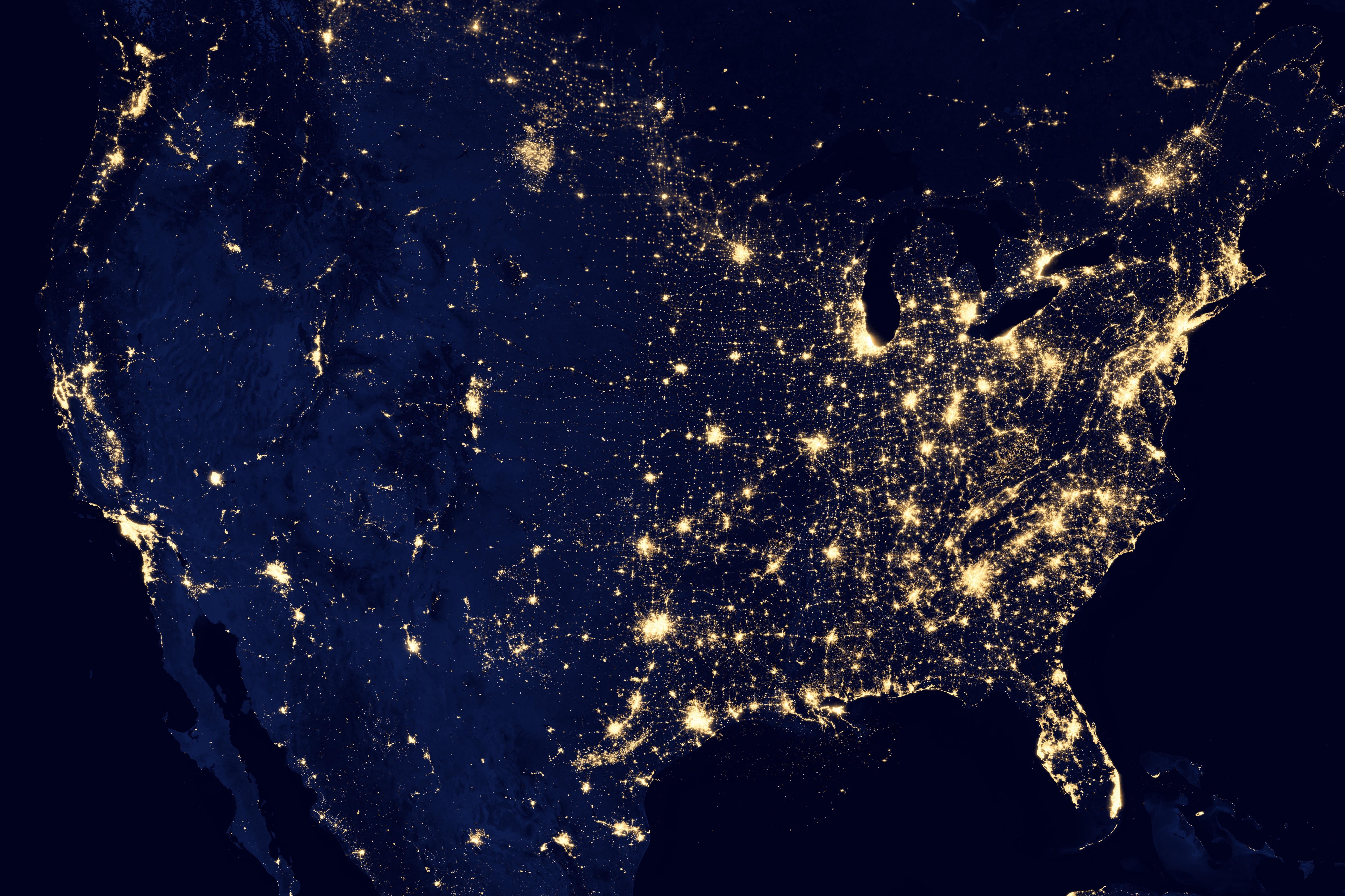
Satellite image at night.
I’m not sure what you’re looking for.
This is a composite satellite image of nighttime light sources.
I can’t think of anything unifying other than “satellite image”.
Thanks
Color
Picture
If you’re talking data viz, maybe a dichromatic chloropleth geo chart or a hot spot/density map?
Yeah heat map seems to be the most generic term for it.
What color is this dress?
Black and gold
Don’t get me started, it white and…!
This looks like a nasa image in their series “earth at night”. Looks like they do this every few years; they did one in 2012 and in 2016. Every once in a while I get a hankering to check it out, and for a while I could never remember what they were called.
Here’s the USA specific one from 2016: https://www.usgs.gov/media/images/photograph-united-states-night
Here’s the global version: https://earthobservatory.nasa.gov/features/NightLights/page3.php
Where’s Waldo?
!solved
Unsolved?
Found the programmer.
Looks like a jpeg to me
I think it needs more jpeg
Uhhh… A picture?
Yes!! finally, thank you


